Navigating Low Water Levels and Shifting Sandbars in Inland Coastal Waters
For many North Carolina boaters, from the Outer Banks to the Cape Fear and everywhere in between, the changing coastal landscape can be as unpredictable as the tides themselves. Shifting sandbars, dredging projects, extreme tides, and unusually low water levels have all made navigation a little more challenging in recent seasons. Knowing how to read these conditions can help you stay safe and protect your boat.
What’s Causing the Changes
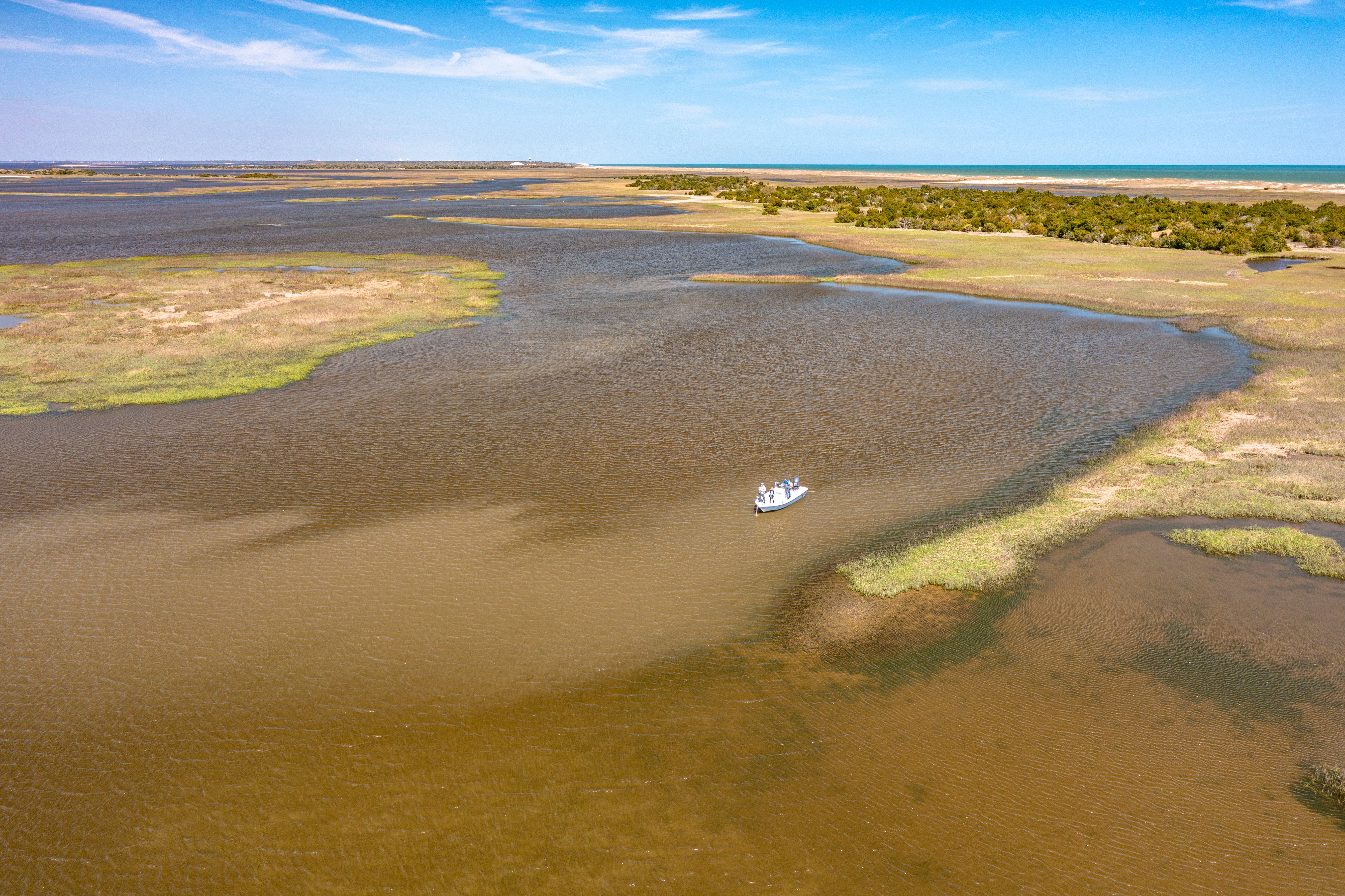
Coastal waterways are constantly in motion. Strong tides, storms, and longshore currents push sand from one area to another, creating new sandbars and shallows where open channels used to be. After major storms or periods of heavy rain, sediment flow can also shift the depth of popular boating routes.
In some inlets, including Oregon, Hatteras, Beaufort, Mason, and Carolina Beach, these changes can happen quickly, making updated navigation charts and local reports more important than ever.
Stay Updated on Channel Conditions
Before heading out, always check recent U.S. Army Corps of Engineers dredging updates or the latest Notice to Mariners for your area. These reports often highlight new shoaling or channel markers that may have moved. Apps like Navionics and Garmin ActiveCaptain also crowdsource local depth readings, letting you see where other boaters have recently reported shallow areas.
Watch the Water and Know the Signs
Even the best tech can’t replace an experienced eye on the water. Watch for color changes—lighter or greener water often means shallow areas or sand just below the surface. Slow down when entering narrow inlets or unfamiliar creeks, and keep an eye on the wake of boats ahead of you for sudden changes in depth.
A good rule of thumb for NC coastal boaters: if you haven’t been through an inlet in a while, treat it like it’s new, wait and watch how other boaters navigate the channels.
Gear to Help You Navigate Safely
A depth finder is essential for spotting sudden drops or rises in the bottom contour. Pair it with side-scan sonar or forward-facing sonar to detect sandbars and obstructions before you reach them. If you run in shallow waters regularly, a trim indicator and jack plate can help you adjust quickly and minimize damage to your prop or lower unit.
And, as always, make sure your tow coverage and marine insurance are current. Even the most experienced captains can find themselves stuck when sandbars shift unexpectedly.
Smooth Sailing Ahead
Boating in coastal North Carolina is all about adaptability. The water will always change—but with the right information, tools, and preparation, you can stay ahead of the tides and enjoy the ride safely.
If you have questions about coverage for damage caused by groundings or submerged objects, talk with the Wells Marine Insurance team. We’re here to help you navigate every part of boating, from open water to shallow creeks.